

Coastal Flooding Solutions: How a North Carolina Community Uses Grassroots Partnerships to Build Climate Resilience
Summer greetings from Lighthouse!
It’s July, and we're feeling the heat here in coastal North Carolina. For communities in North River and beyond, rising temperatures and flood risks aren’t future concerns — they are what we are dealing with right now, and trying to adapt to.
In late June, nearly 80 residents came together — not in response to crisis, but to build a future through the Salt Marsh Cooperative Floodprint. A community-driven blueprint for flood resilience and local control that is gaining momentum quickly!

A breakout group of Merrimon residents maps flood risks in their community with members of North Carolina State University’s Coastal Dynamic Design Lab.
The Floodprint
The Salt Marsh Cooperative — made up of the North River/Laurel Road Ladies Outreach Committee, Lighthouse Environment Partners, the North Carolina Coastal Federation, and the North Carolina State University Coastal Dynamic Design Lab — shows what’s possible when community engagement, organizing, and technical expertise align.
Together, we’re creating a Floodprint— a community-driven resilience plan developed by NC State that puts local voices in at the center of the design process. The goal is to reduce flooding impacts, while honoring both the natural and cultural fabric that makes each place unique. This approach has already helped communities like Princeville and Goldsboro secure major funding for solutions rooted in local priorities.
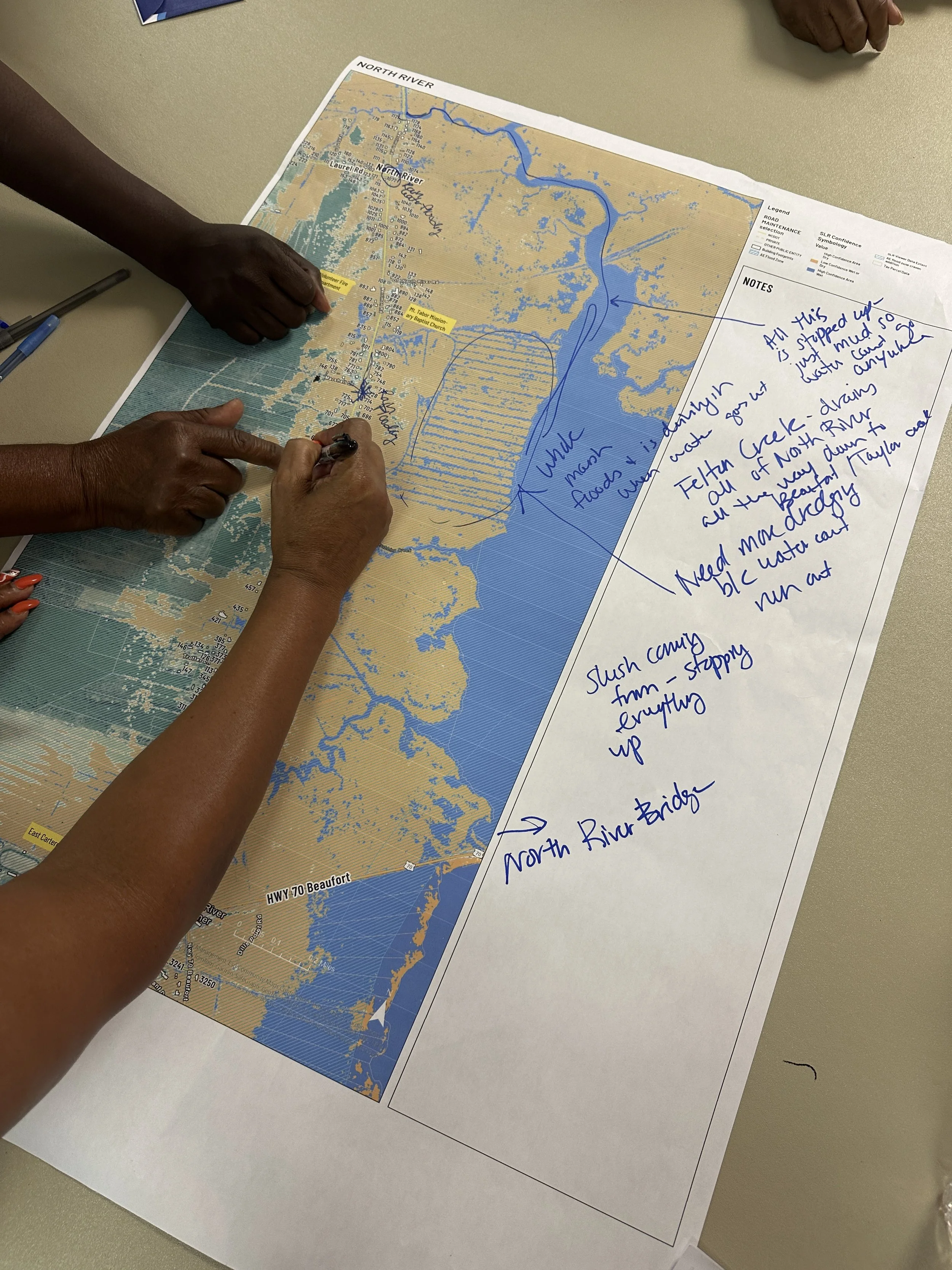
Community members point out how both the landscape and water patterns have changed, which has resulted in flooding of residents’ homes and yards, and the blocking of evacuation routes during king tide and extreme weather events.
Why This Matters Now
The neighborhoods of North River, Laurel Road and Merrimon have long been on the frontlines of coastal flooding and extreme weather. But the scale and pace of change is accelerating.
At our late June workshop, nearly 80 local residents showed up to the first Floodprint listening session. The residents shared powerful stories about their daily reality and how:
Water seeps beneath home foundations
Septic systems are beginning to fail
Salt marshes creep into backyards
Drainage ditches overflow and rarely drain.
Most critically, both road exits from North River can become dangerously flooded during king tides, potentially trapping residents in their homes during emergencies.
These aren't occasional inconveniences, but the new normal here.

The view from one resident’s front yard of Merrimon Road during a king tide event.
Voices from the Workshop
The residents also spoke about what could be done — and who should be doing it.
North River, Laurel Road and Merrimon are just two of fourteen unincorporated communities in eastern Carteret County, all of which lack the infrastructure or support systems of incorporated towns. Without local authority, residents are often left waiting for decisions that directly impact their homes and lives, if those decisions come at all. And with fewer local, state and federal resources available, the need for communities to come together and take action is as strong as ever. As one local expressed it:
“We may be three neighborhoods but we are one community. And we must come together as one.”
Another resident expressed her sentiment like this:
“I’m so happy to come here to see all the family together for something other than a funeral.”
In spite of, or maybe because of, the challenges, many residents express a clear desire to come together, build local capacity, manage services from within, and shape their own future.
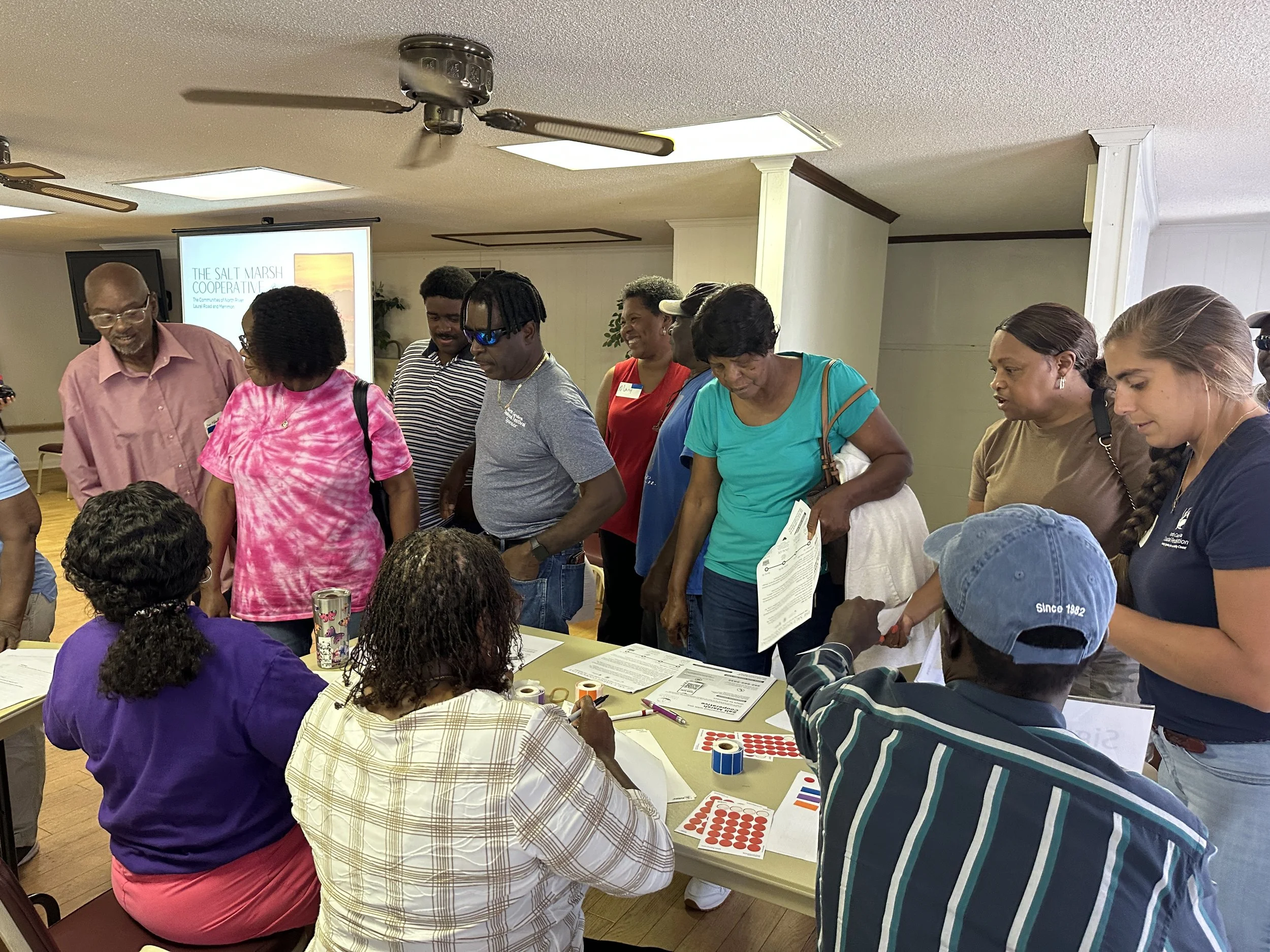
A busy sign-in table for the event.
What's Next
With the listening session complete, we're now entering the design phase. Over the summer, NC State’s Coastal Dynamics Design Lab will develop resilience project concepts based on what residents shared. These will include both life-enhancing improvements and life-saving projects such as:
Stormwater solutions and improved drainage
Elevated infrastructure and emergency access routes
Community-based shelters and repurposed spaces
Nature-based systems to absorb and redirect floodwaters
We will hold a second community workshop in the fall to review draft designs for meeting community needs. Until then, Lighthouse will also be supporting broader partnership development for bringing the vision to reality.
What We Can Do Together
Right after the workshop, our Community Resilience Coordinator, Justin, got calls from seven residents. Not asking for help — just wanting to say they were excited and grateful. That the meeting felt like a turning point.
“After the workshop, the phone calls showed real momentum. People were grateful and excited — but also serious. Learning that the marsh is migrating was eye-opening for many. People started asking, ‘How are we going to live here? What can be done?’ There’s a growing desire to face these changes head-on.” — Justin, Community Resilience Coordinator

Preparing for the next storm now is essential to saving lives and property.
Our partner, The Coastal Dynamics Design Lab, has already helped more than 30 communities across North Carolina recover from storms and plan for resilience. And this is NC State’s 11th Floodprint. Their past collaborations have helped towns secure 8-figures in funding for nature-based solutions — and won national recognition for community-driven design.
It’s not about waiting for the next storm. It’s about planning for both what’s already here — and what’s coming — on the community’s own terms. Can you help us?